For most of history, the view from space was a privilege reserved for the global superpowers. The ability to look down upon the Earth, to monitor its weather, track its resources, and observe its changes, was a strategic asset built on billion-dollar satellites and vast governmental agencies.
This exclusive access created a data divide, where critical planetary insights remained in the hands of a select few. Today, that paradigm is being fundamentally dismantled. A powerful convergence of cheaper, smaller hardware and smarter, more accessible software is sparking a quiet but profound revolution: the democratization of Earth observation.
Nanosatellites: The Hardware Revolution
The catalyst for this shift is the nanosatellite. For decades, launching anything into orbit was a monumental undertaking. Satellites were the size of buses, took years to build, and cost hundreds of millions of dollars to launch. This created an insurmountable barrier to entry for anyone outside of a government space agency or a massive aerospace corporation.
Nanosatellites, some no larger than a shoebox, have completely inverted this logic. Built with off-the-shelf components and designed for mass production, they are exponentially cheaper and faster to deploy. A university, a small startup, or the government of a developing nation can now afford to launch its own constellation of sensors.
This isn’t just about cost; it’s about a fundamental change in strategy. Instead of relying on a single, exquisite satellite, organizations can deploy dozens or even hundreds of smaller ones. This “constellation” approach provides a level of data frequency that was once unimaginable.
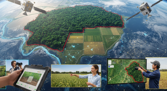
An environmental NGO no longer has to wait two weeks for a public satellite to pass over a protected rainforest. They can now get multiple high-resolution updates per day from a commercial nanosatellite provider, allowing them to track illegal logging or mining operations in near real-time. This high-cadence, affordable access is the first pillar of democratization, putting the power of observation into the hands of those closest to the problem.
Artificial Intelligence: The Great Equalizer
However, access to raw data is only half the battle. The flood of information pouring down from these new constellations would be useless without a way to interpret it. A single satellite can generate terabytes of imagery in a day, far more than any team of human analysts could ever hope to process.
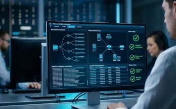
This is where artificial intelligence becomes the great equalizer. AI and machine learning algorithms are the critical software layer that transforms this overwhelming stream of pixels into actionable insight. These systems can be trained to automatically detect specific patterns, such as:
- The subtle discoloration of crops indicating drought stress.
- The change in a river’s turbidity signaling upstream pollution.
- The appearance of new structures in a remote area.
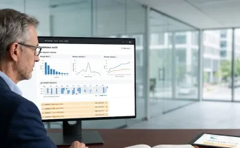
This AI-driven analysis makes the data not just manageable, but meaningful for non-specialists. A small-town urban planner, without a PhD in remote sensing, can now use a service that automatically identifies heat islands in their community. An agricultural cooperative can subscribe to a platform that sends alerts directly to farmers’ phones, advising them on optimal irrigation schedules based on satellite-derived soil moisture data.
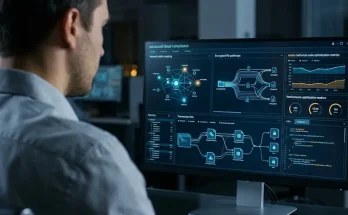
AI acts as the universal translator, converting complex complex geospatial data into intuitive, decision-ready intelligence, effectively lowering the technical barrier to entry.
Advanced Sensors: Adding Depth to the Data
When combined with increasingly accessible advanced sensors like hyperspectral imagers, this democratized stack becomes even more powerful. These sensors, which capture hundreds of bands of light, can reveal the chemical composition of materials on the ground. Once a prohibitively expensive military-grade technology, hyperspectral sensors are now being fitted onto smaller, commercial nanosatellites. This allows a local water authority to monitor for specific algal blooms in a reservoir or a mining company to conduct preliminary mineral exploration without expensive and invasive ground surveys.
From a Top-Down Tool to a Decentralized Resource
The implications of this shift are profound. We are moving from a world where Earth observation was a centralized, top-down tool to one where it is a decentralized, accessible resource. This democratization is fueling a new wave of innovation from the ground up, empowering local communities, entrepreneurs, and researchers to solve problems with a perspective that was once out of reach.
The view from everywhere is no longer a futuristic concept; it is a present-day reality that is making our world more transparent, responsive, and understood.